Share on:
Address
Behind Deeper Life Campground, Mile 6 Bypass, Jalingo, Taraba State
Visiting Hours
Mon.-Fri. 8am - 4pm
Sat. 10am-2pm
Phone
07035166768
jalingo@deeperlifehighschool.org
Welcome Address
by the Principal
We are faith inclined, an academia of moral builders and excellent academic achievers. Ours is to mould lives in tandem with the Creator’s plan and purpose for every child under our tutelage. We don’t just see a need; we leave no stone unturned as we are always determined to meet the needs of our students. For us, every child is important. Our ultimate goal is to raise upright leaders of the future through high quality and sound education.
Deeper Life High School, Jalingo Campus, an offshoot of the main campus in Lagos, was established in September, 2019, to fill the longstanding vacuum of modern educational practice with zero tolerance for examination malpractice, which most lovers of 21st century education had long waited for in the state and its environ. Our trademark of excellent service delivery speaks volume. This is made possible by the super dedication of our unrelenting staff.
Powered by the urge to be ahead of the pack, the DLHS, Jalingo Campus, exposes every child to innovative learning based on the school’s age-long slogan “one laptop per child”. Going beyond the conventional school curriculum, our students are acquainted with the demands of the tech age which are capable of shaping their future. The technological aspect of our learning system arouses students’ interest in exploring and developing their talents towards creativity in such areas as computer programming, Robotics and Artificial Intelligence (AI), web designs, to mention a few, thereby giving them a sense of self-fulfilment.
Our learning activities are not limited to the classroom. We are committed to building good leadership and entrepreneurial skills in our students through practical trainings that will help them acquire self-reliance and profitability in the nearest future.
A record breaker like a lily in the mire, the DLHS, Jalingo Campus, has won several academic awards of excellence at various competitions ranging from Olympiad Mathematics and Science competitions to spelling bee competitions organised on a yearly basis by the popular Nigeria Spelling Bee within and outside Taraba State.
Our cultural or denominational diversities are no barrier to the accomplishment of the school’s vision and mission statements. Our cultural and career day outings are a plus to our wide acceptability within and beyond the confines of our existence.
Part of what gives vibes to our relevance and popularity in Taraba State and the neighbouring states is our numerous sporting activities. Are you a lover of football, volleyball, athletics, scrabble, chess and every other kind of game? Take a drive or catch a flight to Deeper Life High School, Jalingo Campus, for an exciting experience you would ever live to remember.
The satisfaction of our stakeholders (parents/guardians) is our utmost concern. This informs our termly Visiting/Open Day where every parent/guardian is given the ample opportunity to interact with their wards and get to know how they fare in the school. The parents-teachers’ association (PTA) is also a viable tool with which our stakeholders are involved in the all-time growth and progress of the school.
Our cutting edge classroom and hostel facilities are not just admirable, but cozy. It will also shock you to know that it is a ‘crime’ to starve or go on a hunger strike in the DLHS, Jalingo Campus. Our students are fed five times daily with delicious meals to keep them fit for learning throughout their stay on the campus. Indeed, Deeper Life High School, Jalingo Campus, is a home away from home.
Wouldn’t you rather partner with us by enrolling your ward today? Our entrance examination holds on the second Saturday of February every year, unless otherwise stated, and it is based on the curricula developed by the Nigerian Educational Research and Development Council (NERDC) for Basic 4-6. Candidates are tested on the English Language and Mathematics, and subsequently interviewed for possible admission into the Campus.
Have fun as you swipe through the pages of our ultra modern website. A trial will convince you.
Once again, welcome to Deeper Life High School, Jalingo Campus, the home of quality education.
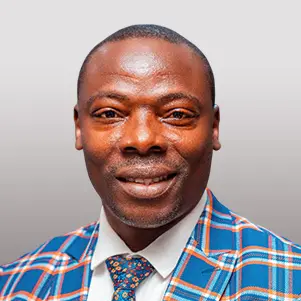
Mr. David Richard
Principal, Jalingo Campus
WATCH CAMPUS FACILITY TOUR
WATCH CAMPUS FACILITY TOUR
Facts & Figures
of Host State
Taraba, a state in north-east Nigeria, is named after the Taraba River, which traverses the southern part of the state. Its capital city is Jalingo. Created out of the former Gongola State on 27 August, 1991, Taraba State has a population of 2,300,736 dwellers (2006 population census) who are spread all over its 16 local government areas with a land mass of 60291.82 Km Sq.
Popularly called Nature’s gift to the nation, Taraba State lies roughly between latitude 6030″ and 9036″ north and longitude 90 10″50″ east with coordinates of 8°00′N 10°30′E. It is bounded by Bauchi, Gombe and Adamawa States in the north-east, and by Plateau State in the north-central. It is further bounded to the north central by both Nasarawa and Benue States, while it shares an international boundary with the Republic of Cameroun to the south and south-east.
Known for its multi-ethnicity, Taraba State is endowed with over 77 different tribes, and their languages including Kuteb, Chamba, Yandang, Mumuyes, Mambila, Karimjo, Wurkums, Jenjo, Jukun, Ichen, Tiv, Kaka, Pena, Kambu, kodei, Wawa, Vute, Fulani, Hausa and Ndola.
Taraba is home to numerous public and private primary and secondary schools with three (3) universities and two (2) colleges of education.
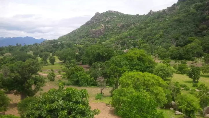
The state is richly endowed with potentials for the development of tourism, and mineral resources which include the recent discovery of uranium in huge quantities in the state. The state government is committed to improving its tourist attractions like the Mambilla Tourist Center, Gumpti Park and game reserve in Gashaka, etc.
By way of proving its emblem, ‘Nature’s gift to the nation’, the mainstay of the state’s economy is agriculture. Taraba State prides itself in the production of cash crops such as coffee, tea, groundnuts and cotton. Crops such as maize, rice, sorghum, millet, cassava, and yam are also produced in commercial quantity. In addition, cattle, sheep and goats are reared in large numbers, especially on the Manbilla Plateau, and along the Benue and Taraba valleys. Taraba State is among the leading states in the production of livestock with its dairy farms at Jalingo, Gembu and Nguorje.
Key Sites
in Host State
Notable key sites/places in host state:

Mambilla Plateau
The Mambilla Plateau is a plateau in Gembu, Sardauna L.G.A of Taraba State, Nigeria. The Mambilla Plateau is about 1,600 metres above sea level and arguably the highest mountain points in Nigeria. The Mambilla is Nigeria’s northern continuation of the Bamenda Highlands of Cameroon. Mambilla plateau is comparatively cold. Daytime temperatures hardly ever exceed 25 °C (77.0 °F) making it the coolest region in Nigeria. Mambilla is also home to the Mambilla tea plantations, Located In Kakara town of the state.

Barup Waterfalls
Barup waterfall is the most popular waterfall in Taraba state and one one the most popular attraction in the state, it is located in Gembu area of the state, within the Gashaka-Gumti national park. Barup waterfall is a sight to behold as it plays host to thousands of visitors every year. The barup waterfall and its environs is a perfect place to relax and enjoy nature.

Gashaka-Gumti National Park
Gashaka-Gumti is a national park in Nigeria, Gashaka-Gumti National Park is located in the mountainous region of north-eastern Nigeria adjacent to the international border with Cameroon, towards the north of Mambilla Plateau covering a total area of 6,731 sq.km both in Adamawa and Taraba States, the Park is contiguous with Faro and Tchabal Mbado National Parks in the Republic of Cameroon. Gashaka-Gumti Park experiences varying pleasant weather conditions, depending on one’s location within the Park. These range from tropical dry humid, tropical moist humid in the lowlands to sub tropical highland weather on the high plateau around Chappal waddi, Sabere and Fillinga.
Bitako Hills and Rock Formations
Located in Zing Local Government Area of Taraba State. The Bitako Hills is a sprawling rock formation situated in Zing, and the sight as well as the spread of the formations is enchanting to both natives and visitors alike. The Bitako Hills is a beautiful place with amazing and breathtaking rock formation, The Bitako Hills is an ideal and perfect place for nature lovers and adventure seekers. It is one of the must see tourist attraction in Taraba state.
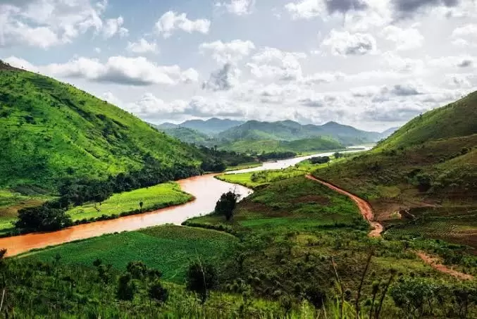
Donga river basin forests
The Donga river basin forests are located on the slopes and at the foot of the Mambilla Plateau, south-west of Gashaka-Gumti National Park. The area is lowland forest beside the Donga river, south of Buru village and about 10 km from the border with Cameroon. The terrain is hilly and rocky and houses over 190 bird species, Dominant tree species include Brachystegia sp, Khaya grandifoliola, Erythrophleum guineensis, Tetrapleura tetraptera, Pterygota macrocarpa, Cleistopholis patens and Garcinia kola. Amongst the many species of lianas present are Entada pursaetha, Laccosperma opacum and Piper guineense. Rainfall is heavy and persistent due to the influence of the neighboring Mambilla Plateau and the Cameroon mountains. Donga river basin forests include Baissa, Amboi and Bissaula River Forest Reserves as well as some areas of unprotected forests near the villages of Akwabe and Akoforo.
Get In Touch With Us!
Phone
07035166768
jalingo@deeperlifehighschool.org
Address
Behind Deeper Life Campground, Mile 6 Bypass, Jalingo, Taraba State
Send a message
[wpforms id="1333"]